Cutting-Edge Basin Modeling Enables Unprecedented Level of Detail
BEAMs successfully created for 15 major Georgia river basins using Hazen’s innovative OASIS platform.
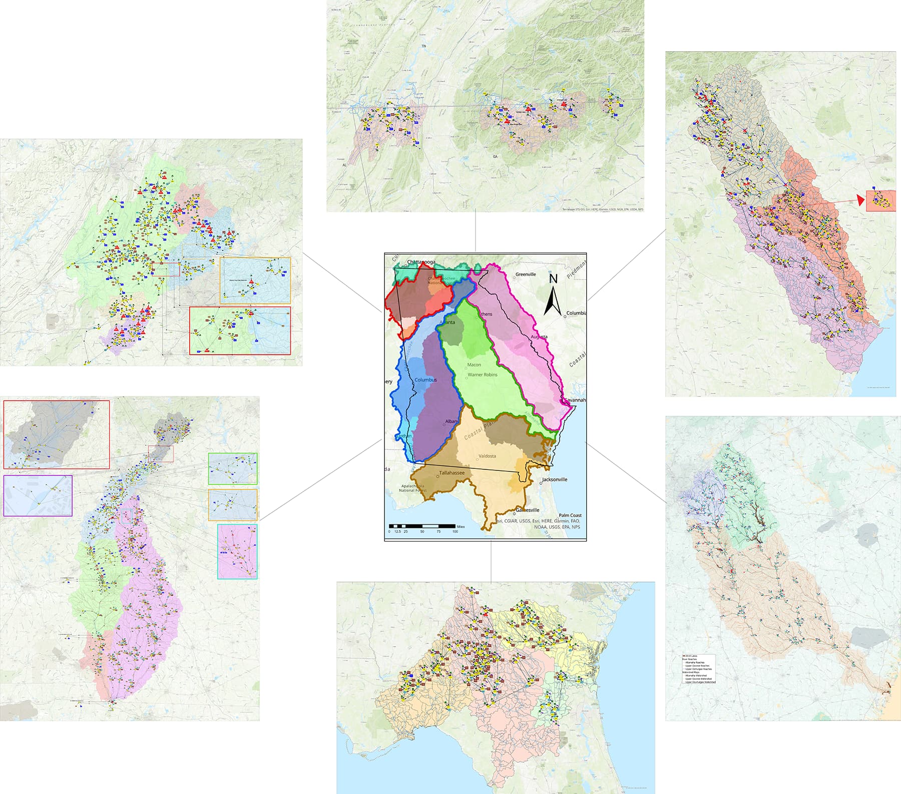
Hazen was contracted to create dynamic Basin Environmental Assessment Models (BEAMs) of surface water flow, storage, and supply availability for 15 major river basins across the state by the Georgia Environmental Protection Division (EPD). Using Hazen’s innovative basin-modeling platform, OASIS, the BEAMs showed water use for each individual supply and discharge facility in the state, a level of spatial detail that is rarely – if ever – seen among similar models.
Project Outcomes and Benefits
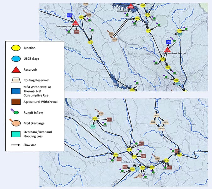
- Highest-spatial-resolution basin models constructed
- Nodes for every individual water withdrawing and wastewater discharging facility explicitly defined
- Each BEAM supported EPD’s water withdrawal permitting activities
- Simulated flows and storage at multiple basin points in response to future demand and historical inflow hydrology
- Locations with potential future water stressors, shortages, and downstream impacts on availability identified
- Feasibility of new and modified permit requests evaluated
- Management solutions during regional water planning efforts identified

Dr. John Clayton is an expert in assessing water demand, supply, and reliability for water resources systems.
Related Solutions:
Hazen used the cutting-edge modeling software, OASIS, to develop high-resolution models of every river basin in Georgia. These models represent every water permittee in each basin.
Field-Leading Modeling Platform Developed In-House
Many basin models simplify spatial details of water use, detailing uses as totals for defined areas and/or use types. The BEAMs developed in this project, however, are among the highest-spatial-resolution basin models ever constructed. In addition to clearly defined nodes, every associated water supply reservoir – and many other points of interest, such as gages and confluences – were also highlighted. The high resolution allowed supply impacts among individual stakeholders to be assessed in ways not possible with more traditional resolutions.
To achieve the required spatial resolution, Hazen devised several enhancements to automate OASIS modeling procedures that are normally performed manually. Hazen owns and actively develops the OASIS platform to support its Integrated Resource Management services. Using OASIS allowed the project team to tackle the complexity of the modeling process without sacrificing practicality. BEAM runtimes for 80-year long daily-timestep records are generally around five minutes; at this runtime, it is feasible to apply the model in a real-time setting during planning meetings, a capability that was technologically unavailable in the past.
Ultimately, the value of basin-level models with this high level of detail facilitates effective planning to ensure that utilities, local governments, and regulatory agencies fully understand the implications of current and future surface water withdrawals. The Georgia BEAM project showed that such value is achievable efficiently and can be easily applied for future, collaborative decision making.

The spatial resolution of BEAMs is significantly higher than that of their ResSIM-based predecessors.
BEAMs create simulations of impacts on water availability throughout each basin, allowing for tests to be carried out on different scenarios, including changing demands or permit modifications.