Tunneling Under Pleasure Bay with an Open-Face TBM
Last Modified Jul 11, 2022
Project background
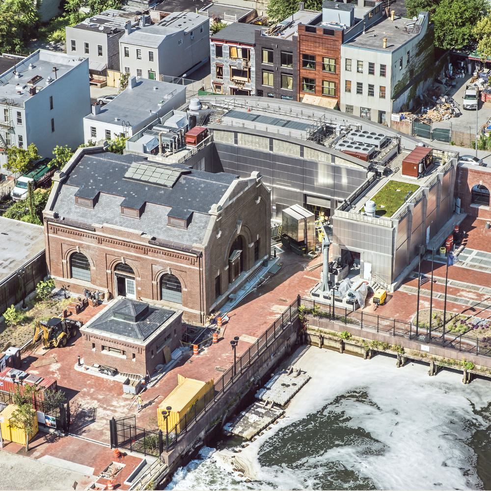
Traversing the Pleasure Bay from the Borough of Oceanport to the Borough of Monmouth Beach, the existing PBI was constructed approximately 50 years ago at depths of approximately 7 to 15 feet below the bottom of the bay, by open-cut using a 48-inch diameter reinforced concrete pipe (RCP). A section of the PBI rests on soft soil, which has reportedly settled over time. Internal inspection also documented pipe sags, buildup of slime, varying degrees of corrosion and spalling, cracks, and evidence of surcharging. Internal corrosion has adversely impacted the integrity and reliability of the PBI, increasing its risk of failure. The consequences of failure of the PBI would include interruption of service to several communities, and significant damage to the environment. The TRWRA has identified these issues concerning the condition of the PBI, as well as MPS structural and mechanical deficiencies. To remedy the risks, TRWRA decided to construct a new PBI and MPS.
Related Solutions:

The Pleasure Bay Crossing and Main Pump Station Replacement Project includes the Pleasure Bay Interceptor Tunnel, which is an approximately 3,250-foot long tunnel extending from the new Main Pump Station Shaft to the Oceanport Shaft, as shown in Figure 1. The tunnel will be excavated by a maximum 10-foot diameter Tunnel Boring Machine (TBM) through stiff to hard marine soils and is not located under any houses along its alignment. A 54-inch diameter fiberglass reinforced tunnel carrier pipe, backfilled with cellular concrete, will be installed within the tunnel. The Main Pump Station Shaft will be used to launch the TBM and, once the tunnel is completed, to construct the new Main Pump Station. The Main Pump Station Shaft will have an excavated depth of about 125 feet and an excavated diameter of about 78 feet. The Oceanport Shaft will be used to recover the TBM and to construct an intake and drop structure. The Oceanport Shaft will have an excavated depth of about 90 feet and an excavated diameter of about 28 feet. A deaeration chamber will be constructed at the base of the Oceanport Shaft.
Geotechnical Investigation Program
Local Geological Setting
The geologic setting in the vicinity of the project consists of Quaternary estuarine and alluvial deposits overlying late Cretaceous and early Tertiary sediments. The alluvial soils are referred to as the Cape May, Pennsauken and Bridgeton formations on the Geologic Map of New Jersey and typically consist of uniform sand and silty sand with some gravel. Most of the Tertiary sediments appear to have been eroded away during episodes of sea-level change. The late Cretaceous sediments in this area consist of Red Bank and Tinton Formations. For this project, these late Cretaceous formations and early Tertiary sediments are not distinguished, rather they are referred to as “marine soil”. The depth of bedrock is typically greater than a few hundred feet throughout Monmouth County.
Subsurface Investigation
The geotechnical subsurface investigation was performed in two phases. The initial investigation was performed in February 2019 and consisted of 10 SPTs, of which 5 borings were performed on land and 5 borings were performed in the Bay on a barge.
During procurement of engineering services for final design, concerns related to settlement of the existing PBI in the vicinity of the channel in the Pleasure Bay led to a decision to construct the tunnel at a lower elevation. Consisting of 17 SPTs and 8 CPTs, the second investigation was performed between August 2019 to February 2020 in order to obtain information on the engineering characteristics of the marine soils, as well as confirm and provide additional information on the depth of the channel in the Pleasure Bay. The borings were drilled approximately from 32 to 152 feet below ground surface on land or below the mudline within the Pleasure Bay. The CPTs were performed to further define the location, shape and depth of the channel in the Pleasure Bay that was first identified by the SPTs. Additionally, a seismic reflection investigation was performed as well for further confirmation. The tunnel elevation is determined primarily based on the depth of the channel with consideration of other factors, which will be discussed in the following sections.
Selected soil samples were tested in the laboratory to assess their engineering characteristics and confirm visual classifications. The laboratory testing program included grain size analyses, moisture content, Atterberg Limits Testing, permeability testing, shear strength testing and corrosivity testing.
As groundwater seepage into the tunnel and shafts is one of the most important considerations in the design, one field permeability test was also performed at each shaft site, respectively. The tests were in accordance with ASTM D6391 Method A.
General Geotechnical Findings
The geotechnical conditions that were identified in the investigations are plotted in Figure 2 – Geotechnical Profile. At both shaft sites, fill and alluvial deposits were identified and the materials primarily consist of fine to coarse sand and gravel intermixed with varying amounts of silt and clay. The fill and alluvial deposits extend down to about 12 feet below ground surface at the Main Pump Station Site on Monmouth Beach and about 6 feet below ground surface at the Dropshaft site on Oceanport. The upper portion of marine soils consists of stratified layers of granular and cohesive soils, extending down to about 45 feet below ground surface at Monmouth Beach and about 20 feet below ground surface at Oceanport. Groundwater was encountered at depths ranging from 4 to 12 feet below grade at both shaft sites.

Very soft estuarine sediments are present in the channel of Pleasure Bay. It is anticipated that these sediments extend down as deep as to about El.-50. Underlaying the very soft estuarine sediments, the upper portion of marine soil in Pleasure Bay consists of stratified layers of granular and cohesive soils and in some sections has thick sandy deposits. The marine soil becomes generally finer grained with increasing depth, composed of mostly silt and clay intermixed with varying amounts of fine to medium sand and trace of gravel. The tunnel is selected to be within the finer grained marine soil and below any significant potential water-bearing granular layers. However, it is anticipated that an occasional thin sandy layer or lens could potentially be encountered in tunnel horizon.
Geotechnical Properties of Marine Soils
The marine soils are divided into two zones based on their consistency, as shown on Figure 2. The upper portion of marine soil is firm to stiff immediately below the alluvial and estuarine deposits and becomes stiff to hard with depth. The tunnel zone, which is defined as extending from El.-70 to El.-95, is entirely within the stiff to hard marine soil. In general, the stiff to hard marine soil is classified as a mixture of low plasticity clay (CL) based on the Atterberg Limit tests.
Permeability of Marine Soils
Given the criticality of ground permeability in selecting the tunnel depth and tunnel construction method in this project, both laboratory and field permeability tests were performed. The field permeability test data implies a practically impermeable material. The laboratory permeability tests, which were performed on samples extruded from Shelby tubes, indicates higher permeability than the field permeability tests. While laboratory testing indicates some semi-pervious conditions, examination of samples of the stiff to hard marine soil indicates that it is low permeability. The higher permeabilities associated with the laboratory tests may be the result of disturbance during extraction from the Shelby tubes.
Strength of Marine Soils
Nine unconsolidated-undrained (UU) triaxial tests (ASTM D2850) were performed to facilitate the total stress analyses that was adopted in the design. In addition, 3 unconfined compressive strength (UCS) tests (ASTM D2166) were also performed. The results further confirm that the stiff to hard marine soils are consistent materials.
Tunnel Design
Tunnel Depth and TBM Selection
Based on the findings of the geotechnical investigation, the design team determined that the tunnel depth would be primarily governed by the depth of channel in Pleasure Bay. Approximately 2 tunnel excavated diameters of separation between the channel bottom and tunnel crown is chosen in order to stay away from the very soft estuarine sediments and limit groundwater seepage during tunnel construction. The tunnel invert at the Main Pump Station, where the TBM will be launched, is therefore determined to be approximately at Elevation -88.5. The tunnel is designed to slope up from the Main Pump Station to the Dropshaft with a slope of 0.15%.
Given the ground and groundwater conditions identified in the geotechnical investigation and experience of other tunnel projects in similar ground conditions, an open mode soft ground TBM is considered suitable and cost effective for the PBI tunnel. The TBM is expected to have a shield and utilize a rotating cutter head with pick spades to excavate the tunnel. The standup time of the marine soil is expected to be sufficient for erection of tunnel initial ground support within the tail shield of the TBM. It is also expected that the TBM can advance itself by jacking against the initial ground support system.
Ground Behavior and Tunnel Initial Ground Support
The potential of clogging (sticky cohesive soil adhering to the cutting head, cutting tools and/or the conveyor system of the TBM) is evaluated based on Hollmann and Thewes (2013) method for open mode TBM tunneling. The potential is considered medium to high for this project. Periodical maintenance or cleanup therefore will be needed to remove build-up on the cutterhead and muck disposal system.
To facilitate the evaluation of ground behavior during tunneling, the water contents from the samples mostly taken in the tunnel zone are plotted on Figure 5 along with the plastic and liquid limits. The results show that the water contents from the samples are generally low. While mostly within the plastic and liquid limits, they are closer to the plastic limit. Given the high undrained shear strength of the ground and the results indicated on Figure 5, it is determined that flowing or raveling ground condition is unlikely to occur during tunnel excavation. The tunnel initial ground support mainly consisting of steel ribs and wood lagging is suitable for this project.
The finite element method (RS2 from Rocscience) is used to further evaluate the ground reactions during tunneling and the measures of tunnel initial ground support. For an open face TBM in soft ground, the tunnel face stability is usually one of the major concerns in the design. Given the consistency of the stiff to hard marine soils around the tunnel, an axisymmetric model is set up to model the tunnel face in 3 dimensions with the 2D program. The model indicates that a majority of tunnel face is still within the elastic stage and therefore will be stable without any support measures.
The ground around the tunnel perimeter becomes plastic approximately 4 to 5 feet behind the tunnel face, indicating that the tunnel initial ground support will need to be erected following the tunnel excavation. A 2D plane strain model is created to model the support and the results confirm that W4x13 steel ribs will be adequate to provide the support in the tunnel.

Groundwater Seepage
Groundwater seepage into the tunnel is another major concern as it would not only cause construction problems but also adversely impact the tunnel stability especially in soft ground if excessive seepage is encountered. To estimate the potential amount of groundwater seepage into the tunnel, a 2D finite element model was developed with inputs from the permeability test results. The permeability of 4.6E-5 cm/sec is chosen for the firm to stiff and stiff to hard marine soils in the model, which generates about 380 gpm groundwater seepage into the tunnel. The final estimate of the steady-state inflow is further adjusted to be up to 100 gpm for the entire length of tunnel based on observations on the soil samples, engineering judgment on the variation of ground permeabilities and previous experience in similar ground conditions. It is noted that thin seams or lenses of sandy silts containing trapped water could occasionally be encountered and initially yield local flows or seeps up to several gallons per minute, however these localized flows are expected to diminish quickly since recharge conditions are poor at the elevation of the tunnel.

Although the groundwater seepage and trapped water in thin sand lenses are not expected to produce sufficient water to jeopardize tunnel construction, as a contingency, the design specifies the TBM to be equipped with flood doors and the Contractor to have on-hand a supply liner plate to install as initial ground support, if needed.
Finished Pleasure Bay Interceptor
Once the tunnel is excavated, the 54-in fiberglass tunnel carrier pipe will be installed and the annular space will be backfilled with cellular concrete, followed by the construction of the Dropshaft and Main Pump Station.
Shaft Design
Ground Conditions
At both Monmouth Beach Shaft and Oceanport Shaft sites, the stiff to hard marine soils are overlain by interbedded clay and silt layers with sand layers, which are generally weaker and more permeable. While the overlaying material is about 20 feet deep at Oceanport Shaft site, it approximately extends from 34 feet deep on one side of the shaft to 45 feet deep on the other side at the Monmouth Beach site.
Ground Behaviors and Shaft Initial Ground Support
Given the relatively weak and permeable materials that overlie the stiff to hard marine soils and the presence of groundwater, the standup time of ground in the upper portion of the shaft is anticipated to be very limited. As the ground transitions to the stiff to hard marine soils with depth, where the ground becomes stronger and less permeable, the standup time is expected to be long enough to allow for shaft excavation in lifts.
Therefore, it is required in the design that a relatively watertight excavation support system, such as a sheet pile wall or secant pile wall, be used to support the ground above the stiff to hard marine soil in order to provide a dry working condition and limit surface settlement due to ground movement or drawdown of the groundwater table. The toe of the watertight excavation support system must be socketed into the stiff to hard marine soil.
In the stiff to hard marine soils, where the ground consists primarily of clay and silt and the groundwater seepage is expected to be minimal, it is anticipated that the shaft will be excavated in approximately 4-foot lifts. At each lift, a steel ring beam will be installed as the initial ground support. Figure 8 is one of the results from the axisymmetric finite element model for excavation sequence of the Main Pump Station Shaft. The model confirms that the excavation in the stiff to hard materials with low permeability may be constructed by lifts and the steel ring beams are adequate to provide the support.
Given the nature of the stiff to hard marine soil when interacting with water, the lagging between ring beams is required to be placed immediately following installation of the next steel ring beam. The permeability of the stiff to hard marine soil is anticipated to be very low, and groundwater inflows in the lower portion of shaft excavation are estimated to be less than 30 gpm at the Main Pump Station Shaft and less than 10 gpm at the Dropshaft, respectively.
Final Structure in Shafts
After the shaft excavation and tunnel construction, the shaft at Oceanport site will be converted into a tangential vortex type dropshaft with 50 MGD capacity, and the rest of shaft will be backfilled with cellular concrete. At Monmouth Beach site, a 50 MGD pump station will be built inside the shaft.

Conclusions
The paper presents the new Pleasure Bay Interceptor Tunnel and Main Pump Station project that is being undertaken by Two Rivers Water Reclamation Authority, Monmouth County, New Jersey, and describes the geotechnical investigation and design considerations and approaches for the tunnel and shafts. Once complete, the new system will provide reliable sewer and pumping service to the community for decades to come.