Advanced 2D Hydraulic Modeling and LIDAR Integration for Resiliency Planning
The increasing threat of extreme storm events leaves many coastal municipalities with the challenge of protecting critical infrastructure and vulnerable populations during heavy rainfall and storm surges. Damage left in the wake of Hurricane Sandy exposed New York City’s vulnerability to coastal storm events. The East Side Coastal Resiliency Project (ESCR) – which proposes a series of berms, floodwalls, and deployables to protect a portion of Manhattan from storm surge – is the first large-scale flood protection project undertaken to protect the City. As part of the ESCR project, significant hydrologic/hydraulic modeling efforts were conducted to identify strategies to manage the stormwater within the protected area. This paper will present the approach for determining the potential impact of stormwater and storm surges on critical infrastructure within an urban area.
Related Solutions:
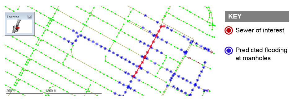
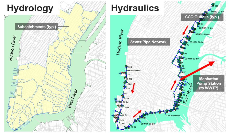
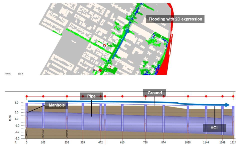
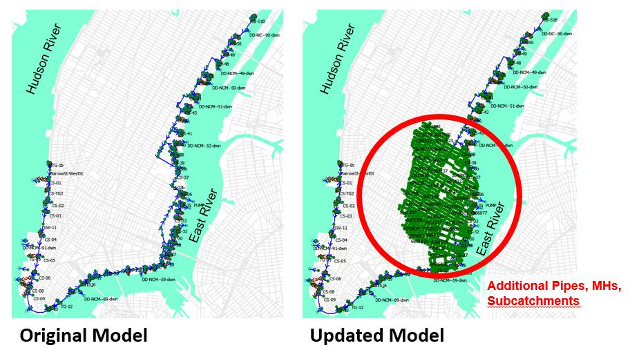
For ESCR, as with other urban settings, it was critical that the model reflect both the flow of water within the city’s sewer system and on the ground surface to understand the performance of water infrastructure under extreme surge and rainfall conditions and the relationship between the hydraulic grade line in the sewers and overland flooding. The ESCR model was developed from an existing InfoWorks CS (collection system) version, and upgraded to InfoWorks ICM (Integrated Catchment Model), in order to take advantage of its 2-dimensional (2D) flood modeling capabilities. The network of sewer pipes and manholes was significantly expanded to include virtually all infrastructure, and subcatchments were subdivided and refined for higher resolution analysis. Aboveground topography (LIDAR), building footprints, and other surface details were also included to accurately simulate the flow paths of floodwaters on the ground surface. The upgraded 2D model was then able to simulate surface flooding extents/depths and capture the dynamic routing of water along the ground surface, which are critical to determining the potential interior drainage management alternatives.
A suite of historical extreme (i.e., hurricanes, including “Sandy”) storms, as well as synthetic design storms, were simulated in the 2D model, to evaluate the effectiveness of a multitude of interior drainage management alternatives. Selected alternatives were then advanced into the next phase of evaluation where constructability, costs, operability and other factors were considered.
The modeling and simulations developed for the ESCR project translate well to similar coastal planning applications, allowing for the simultaneous analysis of above and below grade stormwater and sewer flows for optimized resiliency planning.