Geographic Information Systems (GIS)

Ryan O'Banion is Hazen's Director of Geospatial Services and a leading expert in the development of integrated digital GIS solutions for utilities and municipalities.
Geospatial data provides vital context to a problem. When communities face critical decisions such as selecting a new facility site or which assets to upgrade next, access to the right data can reduce cost, time, and risk. With a robust GIS and experienced analysts, questions about where, how much, how long, and when can all be answered. GIS helps utility leaders and staff, in all types of water projects, make more informed decisions.
Hazen offers geospatial solutions for both the natural and built environment. We support:
- Spatial Analysis and Data Science: Using tools and software to answer questions
- Field Data Collection: Web-based tools for real-time and offline data collection
- Mapping: Static and dynamic map for the web or paper distribution
- Web Applications: Development of visualization and interactive interfaces
- Enterprise GIS Deployment and Assistance: Database schema, management, and start-up support
- Data Integrations: Connecting GIS to CAD, BIM, and asset management systems
Related Solutions:

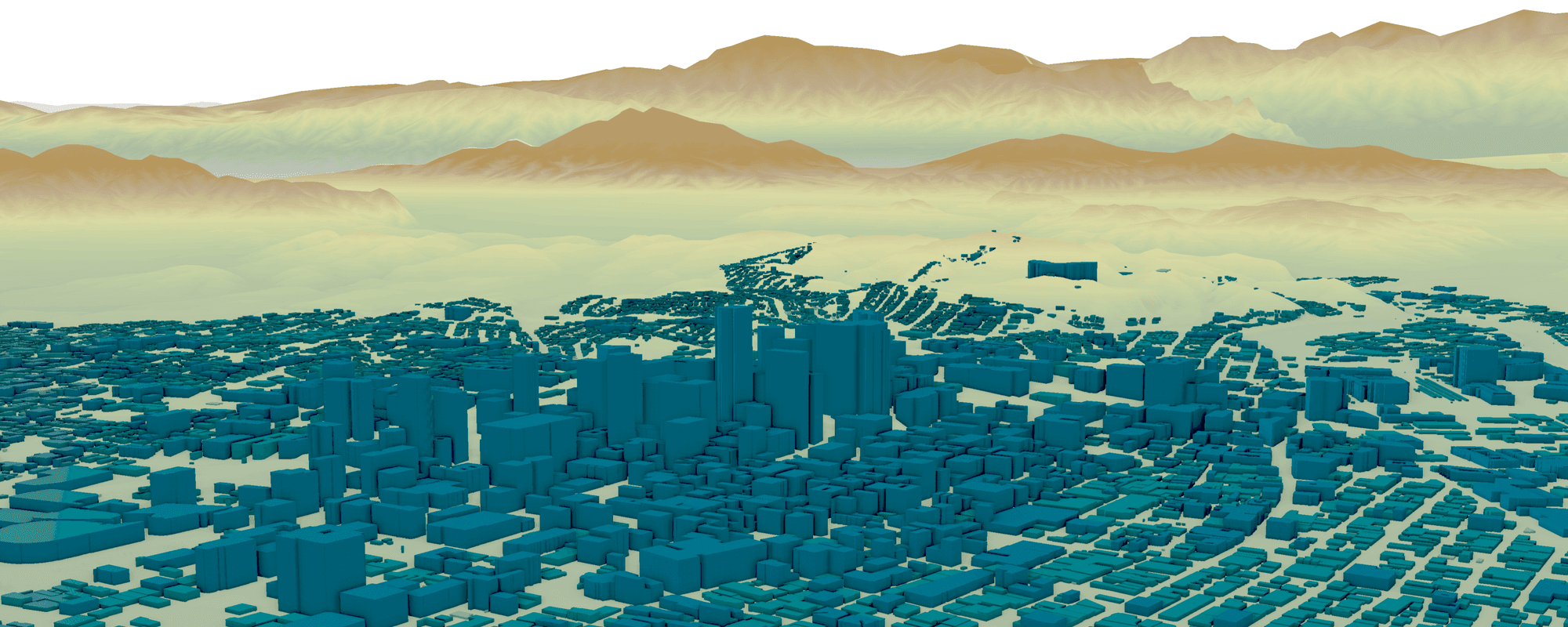
RELATED: Learn more from ArcGIS about how GIS data is the foundation of powerful virtual digital twins that simulate facilities, cities, and natural systems.
GIS technology provides newfound flexibility to connect the data streams you need, even in real time, and provide critical spatial context to your facilities, systems, and landscapes.
Our Work
With experts in all areas from digitization to programming, Hazen provides full GIS support for the water industry. Our deliverables push the limits of available technologies while providing well-documented and dependable GIS solutions.